An AI zoning assistant
built on your ArcGIS data.
Euclid HL links every zoning answer to the parcel, using the layers your GIS team already maintains in ArcGIS Online or ArcGIS Enterprise. Residents see your authoritative data on the map, next to the cited answer.
An address in, the parcel on the map.
 for Temple City, CA

Hi, I'm EuclidHL for Temple City, your planning and zoning assistant. Here are some things I can help you with:
- Want to know the zoning of an address? Type it in and I'll tell you! (e.g., I live at 9608 E Las Tunas Dr. What's the zoning there?)
- Ask about development review or plans for the city's future (e.g., What is the process for development application review and approval?)
- Hint - the more detail you give me, the more accurate my answers will be.
Five layers. Two of them are essential.
Attributed GIS layers connect in hours. If a map exists only as a PDF or image, it can still be brought in, but recreating it is real cartography work and takes longer.
| Layer | What it powers | Needed to launch? |
|---|---|---|
| Zoning districts | "What governs this property": the district behind every parcel answer | Yes |
| Parcels (with APN/PIN) | Finding the lot from an address and highlighting it on the map | Yes |
| Overlay, historic and special districts | The extra rules that apply on top of the base district | Strongly recommended |
| Existing land use | Answers that depend on what adjoins a property; without it those route to staff | Recommended |
| Future land use (comprehensive plan) | Richer answers about the plan and long-range intent | Nice to have |
One question.
The layers behind the answer.
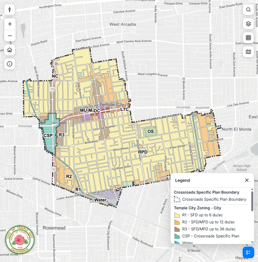
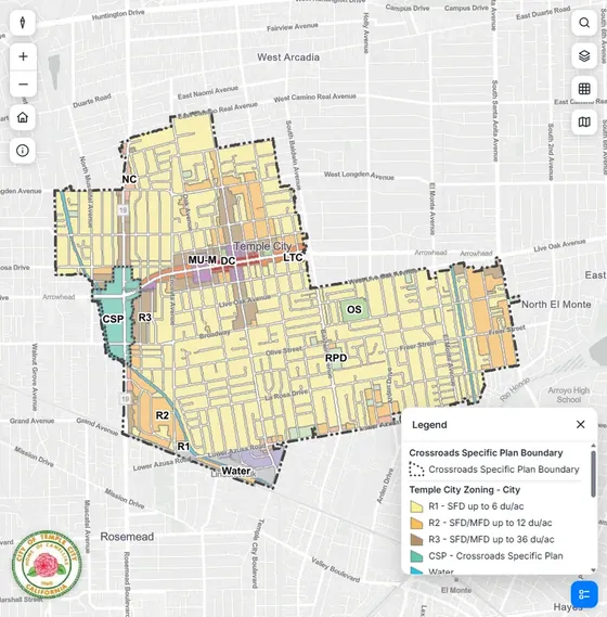
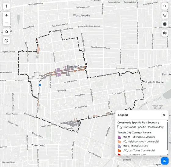
A resident in Temple City asks where a restaurant can open. Euclid HL reads the City's zoning layer, finds the parcels in the districts that allow one, and puts the answer on the map. These are the app's own maps from that answer.
- 01 · ZONING
The City's zoning layer
Every Temple City district, with the Crossroads Specific Plan boundary: the layer GIS staff already maintain.
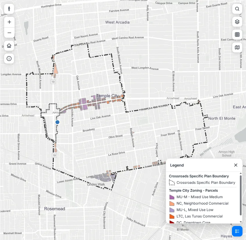
- 02 · PARCELS
The parcels that qualify
The parcels in the commercial and mixed-use districts where the use table lets a restaurant open, along Las Tunas Drive.
- 03 · ANSWER
The answer, on top
A plain-language answer that names the districts and cites the use table, with the map showing exactly where.
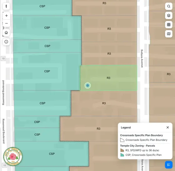
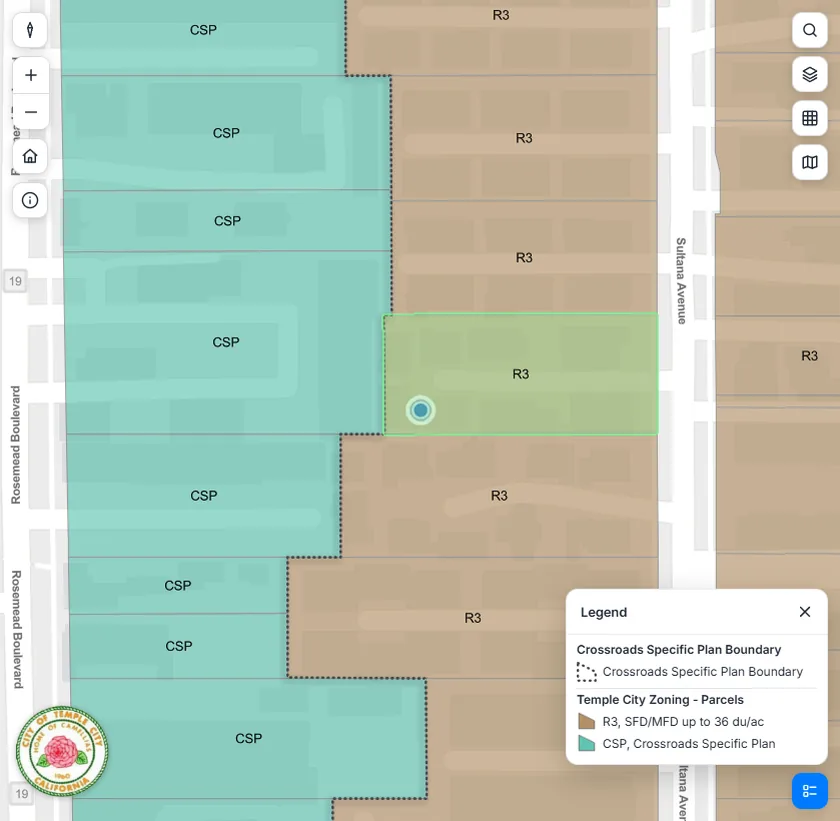
5631 Sultana Ave: R-3
Type an address and the answer starts from that parcel's own district. Here the app found the lot in R-3, next to the Crossroads Specific Plan, and answered with R-3's height limit: 3 stories or 40 feet, whichever is less.
Your services, read where they live.
ArcGIS Online or Enterprise
Euclid HL works from an ArcGIS Online organization, an ArcGIS Enterprise portal, or services a county or regional agency maintains for you. If your services are public, the URLs are usually all we need to start: a web map, an open-data portal or ArcGIS REST endpoints.
Your data, on the map
The map residents see uses the layers your GIS team maintains, so the zoning, parcels and overlays beside each answer are your community's own.
Staff sign in with ArcGIS
Staff tools use ArcGIS sign-in, so your team works with the accounts it already has.
Built for Esri environments
Euclid HL is developed by Houseal Lavigne, an Esri Partner Network Gold partner, and draws its map with Esri's ArcGIS Maps SDK for JavaScript.
Accessible, hosted, and quick to stand up.
Accessibility
The resident-facing assistant is built with WCAG 2.2 Level AA as its target. Ask us for the current audit status as part of your review.
Nothing to install
Euclid HL is a hosted web application. Residents reach it from a link or button on your website; there is no server for your team to run.
Deploy in weeks
Documents are ingested, layers are connected, staff review the answers, and you launch. Most of the effort is on our side.
Security and data handling
We'll walk your IT team through hosting, access control and data handling as part of your evaluation.
Bring your GIS team to the demo.
We'll show the assistant on a live community's ArcGIS layers and go through what your services would need.
Request a demo →